Monday, April 28, 2008

Charleston to Myrtle Beach

View of Charleston skyline as we were leaving on April 26.
Cruise ship in the port next to where were docked...
This is a view of the Spirit of Charleston double masted sailing vessel which was at the end of the dock where we were.


Here is a picture of container ship bring cargo to the US.....
from Singapore !!!
As we entered the ICW rounding Sullivan's Island, this old seawall with a fortification still remained
Traveling down the Wacamaw River part of the ICW was said to be the prettiest part of the waterway on the East Coast. While not as pretty as some of the midwest areas, (predjudiced), it was pretty. Lots of woods similar to the north woods and wildlife. Here is a nest with osprey.
These trees with the overhanging moss and hole were interesting along with the cypress knees along the waterline.
This was just one of the bridges we had to wait to open along the way. We spent one night in Georgetown and bought some fresh shrimp and crab from the local seafood place on Saturday afternoon just before it closed. We had hoped to spend more time in this quaint town, but as in many small towns, absolutely nothing was open on Sunday so we moved on......Nearing Myrtle Beach, this is a privately built and privately maintained 65' bridge across the waterway leading to a gated community on the ocean side !Also in Myrtle Beach is the overhead cable car system which transports golfers from one side of the waterway to the rest of the golf course on the opposite side !Arriving in North Myrtle Beach, we rested at a marina which has its own resident alligator. Looks to be about 8' long. There still were some ducks swimming around here though.......

Saturday, April 26, 2008

Charleston Harbor Cruise

On the day after the Rendezvous, we were on a History tour of the harbor. Here are some of the older homes on the water. The city was first a walled city to protect themselves from the Spanish and the Indians. This part of the city is the Historic District.


Here is the pilot boat from Fort Sumter. It was here that the game of baseball originated about the time of the Civil War.
And a view of Fort Sumter where the Civil War began. During the tour, the biologist pulled up a crab trap to show us the blue crabs. These were mostly females crabs--an easy way to distinguish the females is with the painted nails ! Another way to distinguish was by the round thing on the bottom of the crab.

Here is another view of the Ravenal Bridge across the Cooper River.
This is a view of the Charleston lighthouse on Sullivan's Island. The houses on this island have a problem getting hurricane insurance except from Lloyd's of London..............
This is Fort Moultrie on the northern side of the Charleston Harbor. Charleston is a major seaport with cruise ships as well as cargo ships coming and going. It has a colorful history with pirate lore, some stories pretty gory, early battles, etc. We were told that the chief of the Seminoles, Chief Osceola is buried at Fort Moultrie.


Charleston and the Yorktown

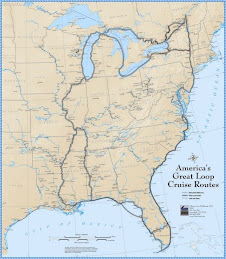
During the Rendevous, we became friends with other "loopers". Darrel and Beth, David and Adrienne (New Mexico), and Bruce and Bonnie(Ft. Myers) and us all went out for dinner on our "free night". During the Rendevous, all our other meals were with the group. On our last night of the Rendevous, we had a tour and dinner on the Yorktown, an aircraft carrier used after 1942 (after the first Yorktown was sunk). Here we are entering the ship. You can see the planes on the flight deck.
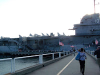

This sub was docked along side of the ship....
Here is a view of the Ravenal Bridge from the ship. In the foreground is the area of the ship where the planes were launched...
The plaque explaining the launch..............

Another plane on the launch deck.....
I would be remiss if I didn't tell you about the dinner. It was first class and we had a choice of spinach stuffed chicken or fillet mignon. Bob had beef and I had the chicken---both were EXCELLENT. We also were served a wonderful salad and a rice medley (wonderful). And the dessert--a rum chocolate topping on cheesecake was to die for. It was a memorable ending to the week.
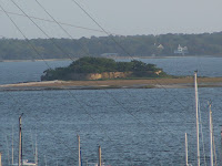
This island was in Charleston Harbor
View of Charleston from the Yorktown--across Cooper River.
An example of houses in Charleston....they have the south side facing porches. Most of the older homes seemed to be built this way.
A woman in the Market Street market making and selling the sweet grass baskets. I learned that the basket that we bought years ago from a woman on the side of the road (we were on a road trip) was worth much much more than we paid. So, from now on, I'll take much better care of it !
Here is a view of the beginning of the market on Bay Street. It extended about 3 blocks with many different vendors. Some have permanent spots, others come intermittently and if there's an opening, they can be assigned to that spot and sell for the day.


Charleston Marina and Plantations

These docks seen on our cruise to Charleston, seemed to stretch forever. And each house had their own dock, stretching forever. We wondered why they wouldn't join together and share one.....
This was our first view of Charleston as we entered the harbor from the south...There were other large ships carrying cargo from all over the world as well as cruise ships.
This was the view from our marina...we were at the Charleston Maritime Center which was right in the historic district. A great place to dock, as we could walk to the farmer's market on Saturday, and to the Market Street where there were local crafters and vendors.

This was the view of the new Ravenal Bridge crossing the Cooper River. Our first tour was to two plantations--the Drayton House and the Middleton Place. The first was the Drayton House which was a preserved site meaning that there had been no restoration. The building was only being maintained to its original state. There were no furnishings. This picture is of the grounds looking from the second floor. The driveway coming in is from the Ashley Road which is narrow with huge overhanging trees--now a Scenic Byway.

And here is the house.......The rear of the house faced the Ashley River which was often their route of transportation to Charleston.

Next we visited the Middleton Place which has America's oldest landscaped gardens first landscaped in 1741. One of the Middletons was a signer of the Declaration of Independence, another was the President of the first Continental Congress, another a governor of South Carolina, with successive family members equally active politically.
This building on the property was to store dairy products and foods because the spring water kept it cool. It was also used as a chapel for the family's slaves until the Civil War.

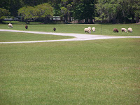
Sheep grazing on the front lawn........... Another view of the pond looking from the house.
This was the Octagal Sunken Garden which was of the three formal gardens on the property. Originally, the gardens where shades of green and eventually, successive Middleton's added colors with azaleas, gardenias and roses.

I don't remember which flower this was but it was used by the slaves who picked the flower and then held it over the mistress's head to shade her !!!!
Here is the Butterfly Garden overlooking the Ashley River. To the left side (not shown) were the rice beds. I was surprised to learn the this area was the largest producer of rice during the 18th and 19th centuries. The slaves who were brought from in from Africa were knowledgeable about growing and harvesting the rice--thus, this was their main crop, not cotton.
This tree is the known as the Middleton Oak and is believed to be over 1000 years old. Indians used this as a landmark when navigating the river. 85' tall, with a circumference of 37' and a limb spread of 145'.
This is the only remaining part of the residence to survive the burning of the plantation in 1865. Because Middleton was an advocate for secession, the Union soldiers were told to destroy this and other properties on their march to the south. We toured the home which is filled with family heirlooms.
We also had lunch at the Middleton Place Restaurant. Southern fried chicken--best fried chicken I've ever had, great pulled pork , rice (of course) and corn pudding which I just tasted and wished I would've taken more. Ended with yummy pecan pie !


Friday, April 18, 2008

Beaufort, SC and Dataw Island

We passed Hilton Head on the way to Beaufort...Here is the Harbortown Lighthouse..... Then we passed by the Parris Island Marine Corps training center....
Beaufort is a pretty town which has maintained its old buildings. The waterfront is inviting with a large green space and at least a dozen of these porch type swings overlooking the water.
This is an example of the buildings in town---the house is now a bank. Streets are narrow and the sidewalks more so...there's barely enough room for 2 people to walk side by side.
Here is another house which is now an inn. There was a wedding going on here when we walked by.
On Sunday, the 13th of April, we went to church at St. Helena's Episcopal which was founded in 1712. Construction of the church was started in 1724. It was used as a hospital during the Civil War. There is a 6' brick fence around the whole block surrounding the church.
As was customary, the cemetary is right outside the church. Again, many headstones dated from the 1700's. It was a surprisingly large church with a wonderful choir.
Leaving Beaufort, we traveled 3 hours that day, averaging 7 mph. We had arranged to stay overnight at Dataw Island where their fuel was the least expensive since we left Cape Coral. When we arrived there, we learned that we were just 6 miles from Beaufort by land roads !!! We have been on so many rivers which are all part of this waterway, and then there are even more creek and other rivers flowing into or out of the ones we've been on. They twist and turn every which way. Without the GPS and chart, you could surely get lost. Here are a couple of alligators near the pond on Dataw Island.
Dataw Island is a purely residential community with the exception of the marina. But we enjoyed taking a bike ride around. We visited the remains of an old plantation which apparantly is one of the best examples remaining of the tabby stone construction. This is the oyster shells held together with cement. Building foundations included the main house, kitchen, some of the slave quarters, stable, and chapel. The family was all buried outside the chapel. Unfortunately, we didn't have the camera along then !!!
After that, we decided to get more information on the island so we went to the welcome center where the local realtor gave us the grand tour. Very nice...here they were still playing croquet (appropriately dressed of course) on the lawn of the clubhouse. Two golf courses, tennis, beautiful clubhouse, and very nicely maintained homes and landscaping. Prices ranged from the high 200's to millions+. I could live there...........
We were held up in Dataw Island for 2 more days because of high winds and cold. At this time of our lives, we prefer to keep warm and we can do that if we're at a dock with electricity. The temperature got into the 40's and with the wind, it was cold !!! So on Wednesday the 15th, with the weather improving, we left for Charleston. We'll be staying at the Maritime Center which is in historic part of Charleston. There are a couple of things Bob wants to do on the boat, and I need some things done....permanent, hair cut, pedicure etc. Next week, there'll be the Looper Rendevous which has scheduled a plantation tour for us as well as a tour of the Yorktown aircraft carrier. Actually, we'll be having dinner one evening on this carrier.